Your email has been sent.
Baden Powell Way Land E 925 Acres of Residential Land in Biggleswade SG18 8WH
Investment Highlights
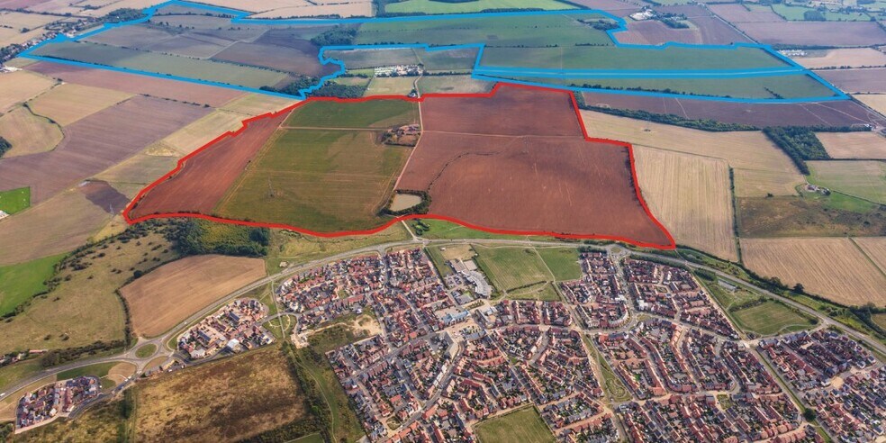
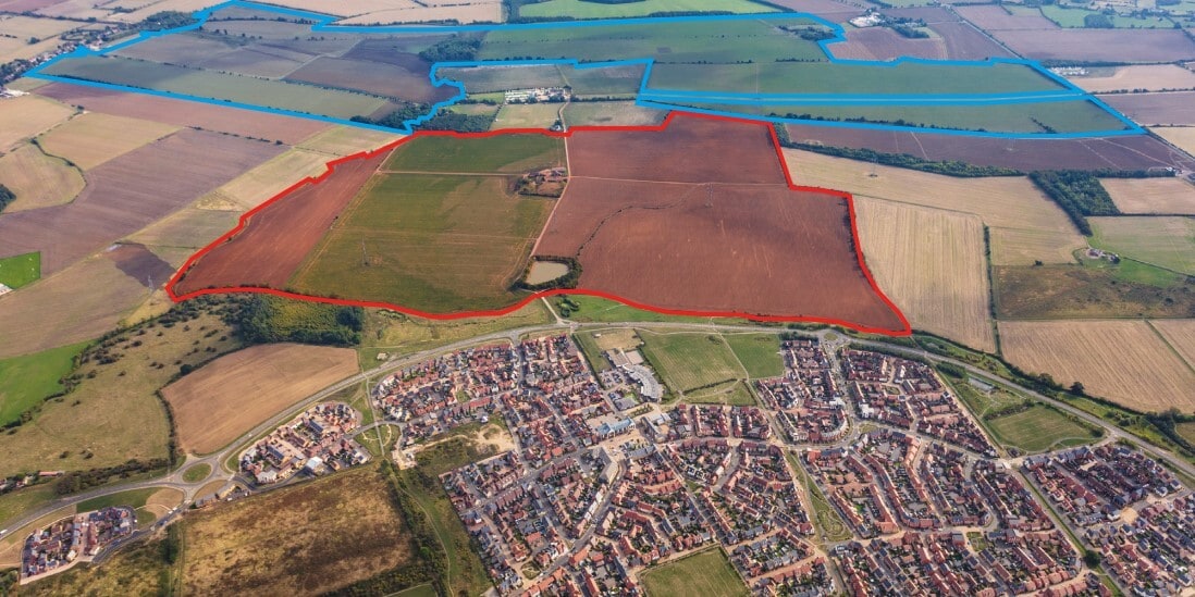
- This site extends to approximately 373.7 ha (925 acres).
- Approximately 136.7 ha (337.79 acres) designated for residential led mixed-use garden village comprising 1,500 dwellings (edged red).
- Resolution to grant outline planning consent subject to execution of the draft section 106.
- Outline planning permission for 1,500 unit scheme lapsed in march 2022.
- Remaining 588.01 acres of land offers an opportunity for strategic land promotion.
Executive Summary
Property Facts
| Sale Type | Investment | Property Subtype | Residential |
| Tenure | Freehold | Proposed Use | Single Family Residence |
| No. Plots | 1 | Total Plot Size | 925.00 ac |
| Property Type | Land |
| Sale Type | Investment |
| Tenure | Freehold |
| No. Plots | 1 |
| Property Type | Land |
| Property Subtype | Residential |
| Proposed Use | Single Family Residence |
| Total Plot Size | 925.00 ac |
1 Plot Available
Plot
| Total Plot Size | 925.00 ac |
| Total Plot Size | 925.00 ac |
The site extends to approximately 373.7 ha (925 acres) in total, the majority of which is being commercially farmed and has been put into sugar beet and maize.
Description
The site is located on the eastern edge of Biggleswade, Bedfordshire. Biggleswade is approximately 40 miles north of Central London and 17 miles southwest of Cambridge. Luton is 15 miles to the southwest, and Bedford is 10 miles to the northwest. Biggleswade had an estimated population in mid-2019 of 21,700, with projections for the population to increase significantly as the town is further developed. The site extends to approximately 373.7 ha (925 acres) in total, the majority being commercially farmed and being put into sugar beet and maize. To the west of the site is Baden Powell Way which marks the current boundary of Biggleswade. The eastern fringe of Biggleswade has seen significant development in recent years, including Kings Reach and, more recently, Orchard Chase. The east and south of the site are adjacent to agricultural land. The village of Sutton marks the site's northern boundary. There are a number of farm buildings and a former farmhouse on the site, together with a series of overhead pylons that pass northwest to southeast through the site's western side.


Presented by
Company Not Provided
Baden Powell Way Land E
Hmm, there seems to have been an error sending your message. Please try again.
Thanks! Your message was sent.