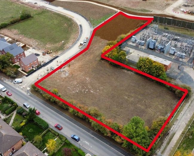
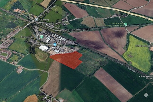
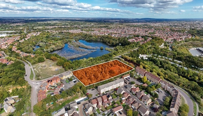
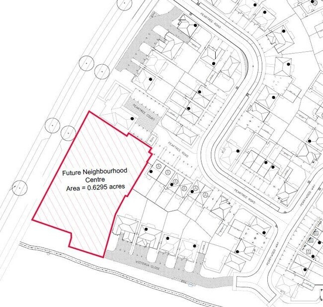
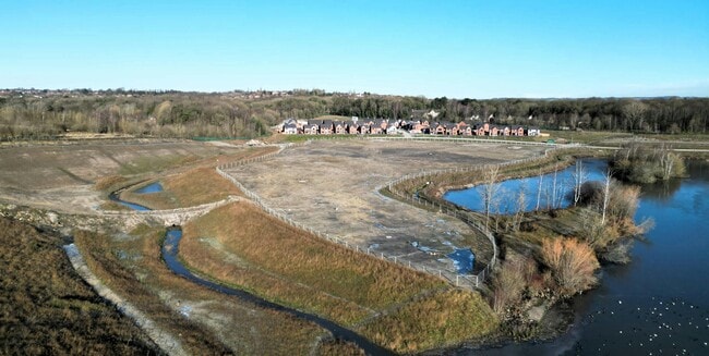
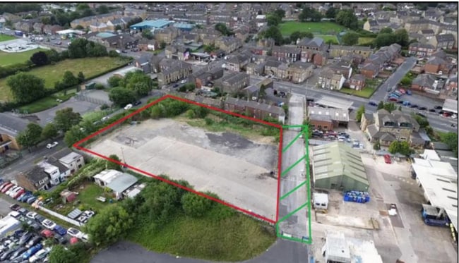
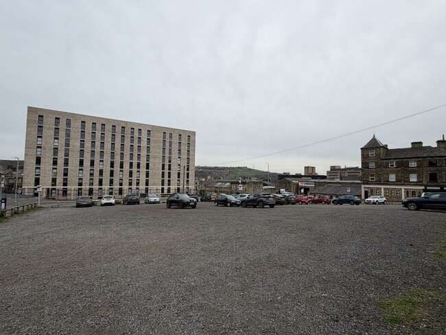
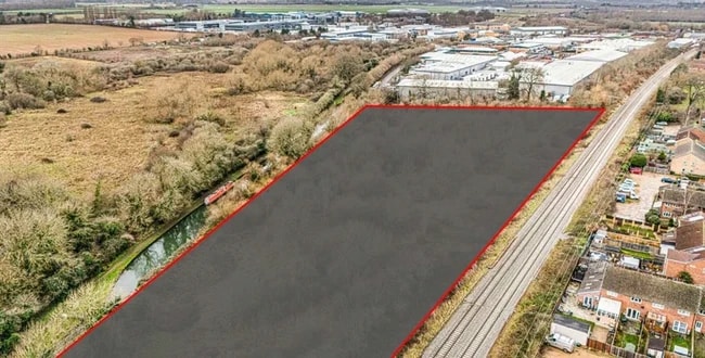
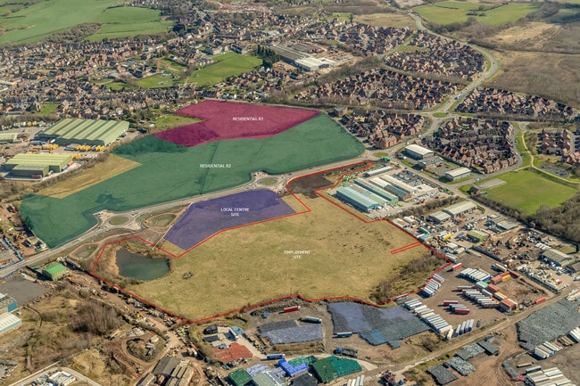
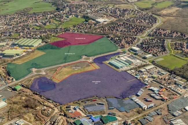
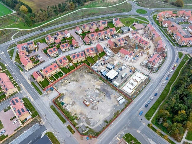
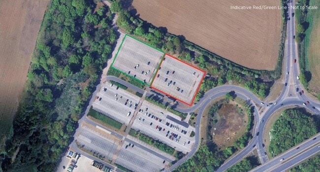
Land in England available for sale
873

Land Plots for Sale in the England

Explore the Latest England Land Plots for Sale - Page 13

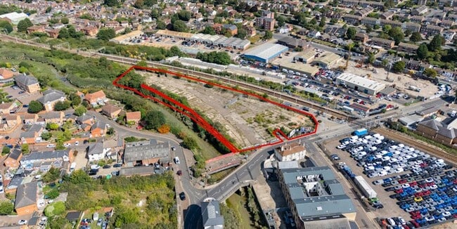
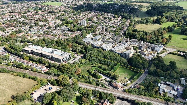
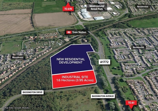
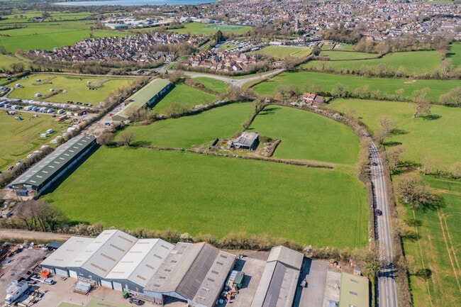
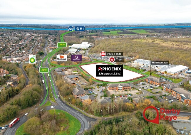
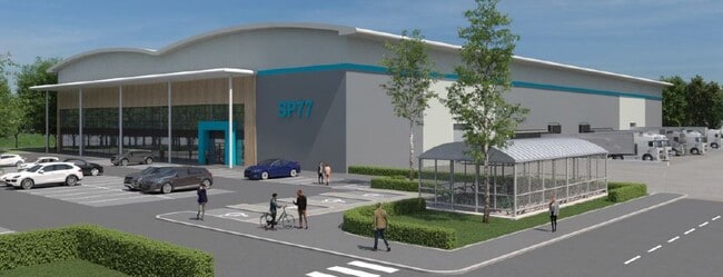
Including commercial development land, industrial plots, mixed-use sites, and brownfield or investment land.

More details for Middleton Rd, Morecambe - Land for Sale

Industrial Development Site - Middleton Rd

Morecambe, LA3 3PW

  • Land for Sale
  • 11 ac Plot
See More
More details for Oxford Rd, Bicester - Land for Sale

34 Acres Office Development Land - Oxford Rd

Bicester, OX26 6WB

  • Land for Sale
  • 13.77 ac Plot
See More
More details for Bassington Ln, Cramlington - Land for Sale

Industrial Development Land - Bassington Ln

Cramlington, NE23 8AD

  • Land for Sale
  • 5 ac Plot
See More
More details for Wicker Lane, Altrincham - Land for Sale

Woodeaves - Wicker Lane

Altrincham, WA15 0HQ

  • Land for Sale
  • 1.71 ac Plot
See More
More details for Dean St, East Farleigh - Land for Sale

Culls Farm - Dean St

East Farleigh, ME15 0PS

  • Land for Sale
  • 1.90 ac Plot
See More
More details for Wango Ln, Liverpool - Land for Sale

Wango Ln

Liverpool, L10 8LQ

  • Land for Sale
  • 26.98 ac Plot
See More
More details for The Meer, Benson - Land for Sale

The Meer

Benson, OX10 6GG

  • Land for Sale
  • 0.61 ac Plot

Benson Land for Sale - Wallingford

LAND SITUATED IN A STRATEGIC POSITION ON THE EDGE OF THE POPULAR SETTLEMENT OF BENSON TO THE SOUTHEAST OF OXFORD EXTENDING TO APPROXIMATELY 0.61 ACRES (0.25 HECTARES) LOCATION The property is situated on the northern edge of the popular village of Benson, within the administration of South Oxfordshire District Council, with frontage onto the B4009 via 'The Meer' from which access is provided. Benson is an attractive Oxfordshire village positioned adjacent to the River Thames and located approximately 11 miles southeast of Oxford and approximately 6 miles east of Didcot. Oxford is a regional city hub providing an extensive range of services and facilities including shops, restaurants, banks, sports centre, retail parks and supermarkets. Facilities in Benson include a Co-op groceries store, Pharmacy, Vet, Community Hall, Primary School, Recreation Ground, public houses and a post office. PROPERTY The Property is a triangular shaped parcel of land, extending to approximately 0.61 acres (0.25 hectares) comprising of predominantly grassland with some scrub vegetation. The Property is bound to the north, east and western boundaries by a new residential development, known as 'Chilton Grange'. The southern boundary adjoins existing residential properties to the south and provides access to the highway via 'The Meer'. PLANNING The Local Planning Authority is South Oxfordshire District Council. The Benson Neighbourhood Development Plan Review was made (adopted) as part of the district council's development plan on 14 March 2023 and identifies the property as a possible location for residential development, although the site is not allocated in the South Oxfordshire Local Plan 2035. An application (reference P04/E0285) for the erection of 8 dwellings, vehicular access and associated parking was submitted in 2004, but was withdrawn prior to determination in 2007. There have been no further known planning applications made. REGISTERED TITLE The land is registered with the Land Registry under Title Number ON9165. Please note that the existing Land Registry title plan includes land that is no longer within the Vendor's ownership. METHOD OF SALE The opportunity is offered for sale freehold. We will be monitoring interest through the marketing period with a view to setting a deadline for bids. It is therefore recommended that prospective purchasers wait to receive further instructions from Carter Jonas before coming forward with any offer. Offers are invited both on subject to planning and on an unconditional basis. The vendors will also consider overage proposals. LOCAL AUTHORITY South Oxfordshire District Council (https://www.southoxon.gov.uk/) RIGHTS OF WAY, EASEMENTS AND COVENANTS The land is subject to public footpath rights of way aligned along the eastern and western boundaries under footpaths reference numbers 125/11/20 and 125/12/10. SERVICES There are no known services currently available on the site. FURTHER INFORMATION An Information Pack has been prepared to accompany these particulars which includes title information. This is available upon request and prospective purchasers should note that the vendors will expect them to have obtained and carefully considered the contents of the Information Pack prior to submitting an offer. For further information or to receive the Information Pack, please contact Carter Jonas. VIEWING The property may be viewed from the highway. Parties wishing to walk the property should arrange an appointment with Carter Jonas.

Contact:

Carter Jonas LLP

Property Subtype:

Commercial

Date on Market:

12/11/2024

Hide
See More
More details for Highworth Rd, Faringdon - Land for Sale

Highworth Rd

Faringdon, SN7 7ED

  • Land for Sale
  • 0.73 ac Plot

Faringdon Land for Sale

LAND SITUATED IN A STRATEGIC POSITION ON THE EDGE OF THE POPULAR SETTLEMENT OF FARINGDON TO THE WEST OF OXFORD EXTENDING TO APPROXIMATELY 0.73 ACRES (0.29 HECTARES) LOCATION The Property is situated on the western built edge of Faringdon, a popular and growing settlement within the Vale of White Horse District Council. The Property has direct frontage onto the Highworth Road, from which access is provided. Faringdon is a growing market town located approximately 15-miles west of Oxford and 10-miles northeast of Swindon. Oxford is a regional city hub providing an extensive range of services and facilities including shops, restaurants, banks, sports centre, retail parks and supermarkets. Swindon also provides for a wide range of services and facilities as well as being a hub for employment in the area. Swindon benefits from direct rail services into London Paddington (approximately 1-hour), as well as having good access onto the M4 motorway via junctions 15 and 16. Facilities in Faringdon include a Waitrose, Tesco Superstore, two Primary Schools, Secondary School, Leisure Centre, Cricket Club, several Public Houses and a Post Office. PROPERTY The Property comprises a former Highways Depot and Youth Centre, in all extending to approximately 0.73 acres (0.29 ha), with access taken from the northern boundary, which fronts onto Highworth Road, from which access is taken. The northern section of the site includes a yard and a number of buildings, which are brick-built under clay tiled roofing. The southern section of the site is made up of an area of raised hardstanding and concrete pads previously understood to have been used for the storage of highways material. There are a number of trees and overgrown shrubs across the site. The south, east and western boundaries front onto newly developed residential housing. The nature of the surrounding housing is generally mixed, mid to low density. PLANNING The Local Planning Authority is Vale of White Horse District Council (VOWHDC). The existing Development Plan for VOWHDC consists of policies from the Local Plan 2031 (Parts One and Two) and identifies Faringdon as a 'Market Town' within the Western Vale Sub-Area. There is a residential development focus around Faringdon with "complementary growth in the Larger Villages" surrounding the town. Faringdon's Neighbourhood Plan comments that "additional residents would help support the critical mass of the town and help it become more self-sustaining" and that there is a need for new housing to provide "a broad mix of types to suit local needs". We are not aware of any recent planning applications which relate to the subject Property. REGISTERED TITLE The land is registered with the Land Registry under Title Number ON282359. METHOD OF SALE The opportunity is offered for sale freehold. We will be monitoring interest through the marketing period with a view to setting a deadline for bids. It is therefore recommended that prospective purchasers wait to receive further instructions from Carter Jonas before coming forward with any offer. Offers are invited both on subject to planning and on an unconditional basis. The vendors will also consider overage proposals. LOCAL AUTHORITY Vale of White Horse District Council (https://www.whitehorsedc.gov.uk/) SERVICES It is understood the Property benefits from utilities connections. FURTHER INFORMATION An information pack has been prepared to accompany these particulars which includes title information. This is available upon request and prospective purchasers should note that the vendors will expect them to have obtained and carefully considered the contents of the Information Pack prior to submitting an offer. For further information or to receive the Information Pack, please contact Carter Jonas. VIEWING The property may be viewed from the highway. Parties wishing to walk the property should arrange an appointment with Carter Jonas.

Contact:

Carter Jonas LLP

Property Subtype:

Commercial

Date on Market:

05/11/2024

Hide
See More
More details for Canal Rd, Taunton - Land for Sale

Canal Rd

Taunton, TA1 1PH

  • Land for Sale
  • 0.63 ac Plot
See More